Interactive Da Lat map: 48 places by type, distances from the lake and routes by area
Our interactive Da Lat map pins 48 places with checked coordinates. Filter by type, tap a pin to open the full guide, or use “Near me” without your location ever leaving the browser. Below: how the city splits into areas, real distances and routes that save time.
By Da Lat LoversPublished Updated How we reviewĐọc bản tiếng Việt
We built this Da Lat map to answer the question every first-time visitor asks: how far apart are these places, and can I see them in the same morning? Each pin is somewhere we have reviewed or covered on this site. The coordinates come from OpenStreetMap and Wikidata, and we checked every one of them on September 28, 2026. Filter by type, tap a pin for a one-line summary and a link to the full guide, or tap “Near me” to sort the list by distance from where you are standing.
- Xuan Huong LakeSights · distance reference pointThe heart of town; the loop around the lake is about 5 km and prettiest at dawn.
- Former Teachers’ College (Lycée Yersin)Sights · 450 m109 Yersin St, still a working school: avoid class hours, ask the guard.
- Da Lat Railway StationSights · Transport · 750 mThree-gabled station and national heritage site; the tourist train to Trai Mat starts here.
- Da Lat Flower GardenSights · 750 mFlower park on the north shore of the lake, easy for kids and older travelers.
- Lam Vien SquareSights · 800 mGlass artichoke and wild-sunflower domes by the lake, best after dark.
- Bui Thi Xuan food streetFood & coffee · 950 mMeatball baguettes, avocado ice cream, grilled rice paper and snails.
- Palace IISights · 1.1 kmThe former Governor-General’s palace off Tran Hung Dao St; not always open, ask first.
- Da Lat MarketSights · Food & coffee · 1.3 kmThe central market: food stalls by day, dried specialties to take home.
- Da Lat Night MarketFood & coffee · Sights · 1.3 kmOpens around dusk by the Nguyen Thi Minh Khai steps: sweaters, grilled snacks, hot soy milk.
- Lam Dong MuseumSights · 1.3 km4 Hung Vuong St; good for rainy days and families with older kids.
- Linh Son PagodaSights · 1.4 km120 Nguyen Van Troi St, about 700 m from the market, free.
- Hotel streets by the marketStay · 1.4 kmNguyen Chi Thanh, Phan Boi Chau and Nam Ky Khoi Nghia: dense with budget hotels, walkable.
- Phan Dinh Phung food streetFood & coffee · 1.5 kmGrilled pork rolls, noodle soup and home-style rice for lunch and dinner.
- Tang Bat Ho food streetFood & coffee · 1.5 kmBanh can and chicken rice rolls in the morning, soy milk at night.
- Chicken Church (Da Lat Cathedral)Sights · 1.6 km13 Tran Phu St, free; a working church, so avoid Mass times.
- Hai Ba Trung food streetFood & coffee · 1.7 kmChicken hotpot with e leaves, stuffed snails and barbecue for dinner.
- Da Lat intercity bus stationTransport · 2.1 km1 To Hien Thanh St at the top of Prenn Pass; many operators drop off at their own offices.
- Domaine de Marie ChurchSights · 2.1 kmPink-walled church on Mai Anh hill, 1 Ngo Quyen St.
- Hoang Dieu food streetFood & coffee · 2.2 kmMeatball baguettes, chicken rice, grilled rice paper and beef hotpot in the alleys.
- Crazy House (Hang Nga Guesthouse)Sights · 2.3 km3 Huynh Thuc Khang St; narrow, steep stairs, not for anyone afraid of heights.
- Palace ISights · 2.3 kmReopened on June 15, 2026 with free entry; grounds of about 16 ha.
- Palace III (Bao Dai’s Summer Palace)Sights · 2.7 km1 Trieu Viet Vuong St; mostly indoors, good on rainy days.
- Cable car station (Robin Hill)Transport · Sights · 2.5 kmTop of the 2,267 m cable car line, about 12 minutes one way down to Truc Lam.
- Cable car station (Truc Lam)Transport · 4.7 kmLower end of the cable car, next to Truc Lam Monastery and above Tuyen Lam Lake.
- Truc Lam Zen MonasterySights · 4.8 kmOn Phung Hoang hill above Tuyen Lam Lake; dress modestly and keep quiet.
- Datanla WaterfallSights · 4.9 kmOn Highway 20 at Prenn Pass, with an alpine coaster; check the pass before you go.
- Tuyen Lam LakeSights · 6.6 kmA lake of about 320 ha in the pines, some 7 km from the center.
- Pinhatt PeakCloud hunting · 7.6 kmAbout a 3-hour hike from near Tuyen Lam Lake; go with someone who knows the trail.
- Clay Tunnel (Sculpture Tunnel)Sights · 8.0 kmInside the Tuyen Lam Lake area, about 13 km from Da Lat Market.
- Berry Valley HomestayStay · 3.7 kmWooden homestay with a strawberry greenhouse on Thanh Mau St; pin placed by street only.Approximate location (street only)
- Valley of LoveSights · 3.7 km3-7 Mai Anh Dao St; suits couples, families and first-timers.
- Da Phu HillCloud hunting · 6.4 kmA close-in cloud-hunting hill toward Ankroet; slippery dirt slope, no fixed services.
- K’Ho CoffeeFood & coffee · 8.2 kmFarm and roastery at the foot of Lang Biang, with coffee-making tours.
- Langbiang Mountain (Radar Hill)Sights · Cloud hunting · 10.4 kmAbout 12 km from the center; jeeps run up to Radar Hill, the main peak is 2,167 m.
- Dankia - Suoi Vang lakesSights · 10.6 kmAbout 20 km north; a drinking-water reservoir, so no swimming or littering.
- Cu Lan VillageSights · 13.0 kmAbout 20 km out; a forest village by a stream, avoid wading after heavy rain.
- Binh Minh Oi CaféFood & coffee · Cloud hunting · 2.2 km89 Hoang Hoa Tham St, a sunrise-and-clouds café that opens early.
- Than Tho LakeSights · 3.6 kmIn Lam Vien ward, about 6 km out; the old pine forest is not what old photos show.
- Cheo Veooo CaféFood & coffee · Cloud hunting · 3.7 km116 Hung Vuong St, a hillside café for sunsets, about 4-5 km from the market.
- Linh Phuoc Pagoda (Bottle Pagoda)Sights · 5.5 km120 Tu Phuoc St in Trai Mat, about 8 km from the center; free.
- Trai Mat StationTransport · 5.7 kmEnd of the tourist train line from Da Lat; walk on to Linh Phuoc Pagoda.
- Cau Dat tea hillsCloud hunting · Sights · 14.3 kmAbout 20-25 km southeast; best at dry-season sunrise, the busiest cloud-hunting spot.
- Van Thanh flower villageSights · 3.7 kmWest of the center; working family gardens, ask before you walk in.
- Me Linh Coffee GardenFood & coffee · 12.2 kmCafé, garden and weasel-coffee area in Cam Ly ward; check the menu first.
- Lien Khuong AirportTransport · 24 kmAbout 30 km from the center, reopened on August 19, 2026.
- Samten Hills DalatSights · 28 kmA Buddhist complex in Don Duong, about 35-44 km from the center depending on the source.
- Pongour WaterfallSights · 35 kmOn the Da Nhim River about 50 km south; stay off the rock tiers in the wet season.
How to use this Da Lat map
The Da Lat map opens zoomed out over the city and its edges. Three far-flung pins, Pongour Waterfall, Samten Hills and Lien Khuong Airport, sit off the bottom of the default view; drag south or tap “Show all” while filtering to see them. Scrolling the page will not zoom the map, so you can keep reading; zoom with the plus and minus buttons or pinch on your phone.
- Filter by type: five colored buttons sit above the Da Lat map: Sights (purple), Food and coffee (pink), Cloud hunting (green), Stay (blue) and Transport (yellow). Some places belong to two groups. The Cau Dat tea hills, for instance, are both a sight and a sunrise spot, so they show up under both filters.
- Tap a pin: a small card shows the name, a one-line summary, the distance from the lake, a “Read the guide” link to our full article (or the exact section of our 30-places guide) and a “Directions” link that opens Google Maps with the coordinates.
- Use the list: it is grouped into six areas and sorted from nearest to farthest within each. “Show on map” flies the map to that place and opens its card. The whole list works with the Tab key and screen readers.
- Near me: your browser will ask for location permission. Say yes and the map marks where you are, zooms to the five closest places and re-sorts the list by distance from you.
Where does my location go?
Where the Da Lat map data comes from
A map is only as good as its pins. For each place on the Da Lat map we searched OpenStreetMap by name (through its Nominatim search, at under one request per second as its usage policy asks), then compared the result with Wikidata and Wikipedia where they had coordinates. When two sources disagreed, we looked at the base map to see which pin sat on the actual building or on the street named in the address.
That step matters. The coordinates on the Vietnamese Wikipedia page for Truc Lam Zen Monastery (checked September 28, 2026) put it about 3 km east of where it really stands on Phung Hoang hill, while Wikidata and OpenStreetMap agree with each other. Copy that blindly and the pin lands in a residential area near Than Tho Lake. On our Da Lat map, the monastery and the cable car station below it follow OpenStreetMap and sit a few hundred meters apart, as they do on the ground.
Three kinds of pins need a word of explanation. Food streets and hotel streets are whole roads, so we pinned the stretch closest to the center. Berry Valley Homestay has no pin of its own on OpenStreetMap, so it sits on Thanh Mau Street and is labeled approximate. Finally, Du Sinh hill, Thien Phuc Duc hill and Hon Bo peak appear in our cloud-hunting guide, but we could not find coordinates we could verify, so we left them off rather than guess.
How distances are calculated
The kilometer figure next to each place on the Da Lat map is the straight-line distance from the middle of Xuan Huong Lake, worked out with the haversine formula on a sphere with a radius of 6,371 km. It runs in your browser and calls no outside service. Straight lines are always shorter than roads, especially in a hill town where routes wind around slopes, passes and lakes. The distance table further down puts both numbers side by side.
Reading the Da Lat map by area
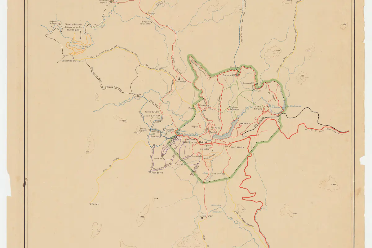
At first glance, the pins form one dense cluster around Xuan Huong Lake (Hồ Xuân Hương) and then spread out along a few main roads. We split the Da Lat map into six areas along those roads. They line up with the eight clusters in our guide to 30 places to visit in Da Lat, just grouped by direction so they are easier to remember. Da Lat sits at about 1,500 m on the Lang Biang Plateau in Lam Dong province (Wikipedia), which is why almost every road between areas climbs or descends.
A note on addresses before you compare pins with your phone: on July 1, 2025, the old Da Lat City was reorganized into wards that all end in “Da Lat”, such as Xuan Huong - Da Lat, Cam Ly - Da Lat, Lam Vien - Da Lat, Xuan Truong - Da Lat and Lang Biang - Da Lat. Map apps and hotel listings mix the old numbered wards with the new names, so searching by place name is usually faster than searching by address.
The center, around Xuan Huong Lake
This is the densest part of the Da Lat map: the lake, Lam Vien Square, Da Lat Market and the night market, the Chicken Church, Linh Son Pagoda, the railway station, Palaces I, II and III, Crazy House, Domaine de Marie, five food streets and the budget-hotel streets near the market. Almost everything lies within 3 km of the lake, and many pairs are only a few hundred meters apart. Details are in cluster A and cluster B of our main guide.
You can walk the center if your legs are ready for hills. The climbs from the market to the Chicken Church and from the lake to the station are longer than a flat map suggests. If you join a group tour, expect some walking: according to CafeF (July 31, 2026, in Vietnamese), from August 1, 2026 vehicles with more than 29 seats, except city buses, are barred from part of Hai Ba Trung Street and may not park on Nguyen Van Cu, Ba Thang Hai, Pham Ngu Lao, Ba Trieu or Nguyen Chi Thanh.
South: Prenn Pass and Tuyen Lam Lake
Follow Highway 20 south on the Da Lat map and you pass the cable car station on Robin Hill and Datanla Waterfall, then turn off into the Tuyen Lam Lake area with Truc Lam Zen Monastery, the lower cable car station, the Clay Tunnel and Pinhatt peak. These places are 2.5 to 8 km from the lake in a straight line. Our Da Lat cable car guide explains how to ride down to Truc Lam instead of driving the pass, and Datanla Waterfall sits right on the pass road.
Check Prenn Pass before heading this way. According to Tuoi Tre News (September 23, 2026), Lam Dong declared an emergency over repeated landslides on the pass. It is open, but with warning signs and traffic control; daylight and dry weather are the safer choice.
North: Lang Biang, Dankia and the Valley of Love
Head north along Phu Dong Thien Vuong and Mai Anh Dao streets and you reach the Valley of Love first, then the Lang Biang area: Langbiang Mountain (pinned at Radar Hill, where the jeeps drop visitors), Da Phu Hill, the K’Ho Coffee farm, the Dankia - Suoi Vang lakes and Cu Lan Village. This is the most spread-out area; the Valley of Love and Cu Lan Village are about 11 km apart as the crow flies. See cluster E and cluster H. VietNamNet once described Cu Lan as a village by a clear stream with fishing and climbing, an easy escape from town (VietNamNet, January 19, 2019).
East: Trai Mat, Cau Dat and the valley-view cafés
To the east you find Than Tho Lake, the Binh Minh Oi and Cheo Veooo cafés, Trai Mat station and Linh Phuoc Pagoda, and further out the Cau Dat tea hills. The tourist train from Da Lat station to Trai Mat runs parallel to this road, so one morning can combine the train out, the pagoda and a ride back. Cau Dat is the farthest pin in this area, about 14 km in a straight line, while the news reports we cite put the drive at 20 to 30 km.
West: Van Thanh flower village and toward Ta Nung
The west is the emptiest corner of the Da Lat map. Van Thanh flower village is about 3.7 km from the lake, and Me Linh Coffee Garden lies farther out toward Ta Nung, about 12 km in a straight line. Van Thanh is a working farm village, so ask before walking into a greenhouse. The weasel-coffee debate and drink prices at Me Linh are covered in our Da Lat coffee guide.
Further out: Don Duong, Lien Khuong Airport and Pongour
The three pins at the bottom edge are outside the city proper. Lien Khuong Airport is about 30 km from the center by road. Samten Hills is in Don Duong, 35 to 44 km away depending on the source and about 15 km from the airport (see our Samten Hills review). Pongour Waterfall is about 50 km south. If you fly in, slotting Samten Hills into your arrival or departure day saves a separate trip.
Da Lat distances: straight line vs. road
The table pairs the straight-line distance our Da Lat map calculates with the road distance quoted, with sources, in our other guides. The gap is widest where the road has to cross a pass or loop around a lake. For a quick estimate, multiply the map figure by about 1.3 inside the city and by 1.5 to 2 for the outskirts.
| Place | Straight line | By road (per source) |
|---|---|---|
| Datanla Waterfall | 4.9 km | About 5 km (Lam Dong Newspaper) |
| Than Tho Lake | 3.6 km | About 6 km |
| Tuyen Lam Lake | 6.6 km | About 7 km |
| Linh Phuoc Pagoda | 5.5 km | About 8 km |
| Da Phu Hill | 6.4 km | About 10 km (VnExpress, 2022) |
| Clay Tunnel | 8.0 km | About 13 km from Da Lat Market |
| Langbiang Mountain | 10.4 km (Radar Hill) | About 12 km |
| Dankia - Suoi Vang lakes | 10.6 km | About 20 km |
| Cau Dat tea hills | 14.3 km | About 20-30 km, sources vary |
| Lien Khuong Airport | 23.6 km | About 30 km |
| Samten Hills | 28.2 km | About 35-44 km, sources vary |
| Pongour Waterfall | 34.9 km | About 50 km |
Datanla barely changes because it sits on Highway 20 and the road runs almost straight. Dankia nearly doubles because the road swings around Lang Biang. With only half a day, pick places where the two numbers are close and you will spend less of it in traffic. VnExpress International’s list of must-see places uses the same road figures, such as Cau Dat at about 25 km and Datanla at about 5 km from the center (VnExpress International, March 22, 2025).
Suggested routes by cluster on the Da Lat map
These routes are built purely from where the pins sit on the Da Lat map, to keep backtracking to a minimum. Check opening hours and prices in each place’s guide before you go. Our 3-day route by cluster goes into more detail, and the 2-4 day itineraries with costs are in our Da Lat travel tips.
- Half a day on foot around the lake: the Flower Garden, along the shore to Lam Vien Square, up to the railway station, back to the market and dinner at the night market. The legs add up to only about 5 km in straight lines, but two of them are steep.
- A southern morning without crossing the pass twice: the Robin Hill cable car station, the gondola down to Truc Lam, a walk by Tuyen Lam Lake, then a taxi to the Clay Tunnel. Stop at Palace III on the way back to town.
- An eastern morning by train: Da Lat station, the train to Trai Mat, Linh Phuoc Pagoda, then a ride to Than Tho Lake or sunset at Cheo Veooo. Train times and fares are in our railway station guide.
- A northern day: the Valley of Love in the morning, Lang Biang before noon, and K’Ho Coffee or the Dankia lakes in the afternoon. In the rainy season, flip it and go up Lang Biang first, since afternoons often turn wet.
- A cloud-hunting dawn: switch on the Cloud hunting filter of the Da Lat map and choose by how far you are willing to ride in the dark. Da Phu is closest; Cau Dat is the busiest and easiest road but the farthest. Weather signs and start times are in our cloud-hunting guide.
Still undecided? Check the live weather widget on our home page to see whether rain is coming, or try the random place picker, then come back to the Da Lat map to group nearby places into one outing.
Getting between areas
The center is walkable; almost everything else needs wheels. Motorbikes are still the most common way to reach the outlying pins of the Da Lat map, but foreigners need a license recognized in Vietnam. The rules, rental prices and what Lam Dong changed in 2026 are in the getting around section of our travel tips. Taxis and ride-hailing apps work well within about 10 km of the lake; for Cau Dat, Samten Hills or Pongour, hiring a car with a driver for the trip gives you more control.
The intercity bus station and Lien Khuong Airport are under the Transport filter of the Da Lat map. Many bus companies skip the station and drop passengers at their own offices in town, so ask where you will be let off. Our Ho Chi Minh City to Da Lat guide covers arrival points.
Mountain passes in the rainy season
Offline Da Lat map tips
Mobile coverage is fine in central Da Lat, but not always in the pine forests, on the passes or on cloud-hunting hills at 4 or 5 a.m. According to Dan Tri (September 27, 2026, in Vietnamese), the city is ringed by nearly 20,000 hectares of three-needle pine forest, so many of your rides will run through trees. A few things to do before leaving your hotel:
- Download an offline map of the Da Lat area in the app you use. Google Maps has offline maps, and apps built on OpenStreetMap data can download the whole province.
- Open this Da Lat map while you still have signal and keep the tab open. The list of places and summaries is already in the page and needs no reload; the map background does need data, so areas you have not viewed may show blank tiles.
- Save the places you plan to visit, and where you will park, as favorites in your map app. At Da Phu Hill or on the Pinhatt trail, the parking spot and the trailhead are rarely the same place.
- Phone batteries drain fast in the cold and with GPS running. Carry a power bank and turn location off when idle.
- Tell staff or your group your route before heading into forest or up a mountain. Tuoi Tre News reported two travelers lost on Langbiang Mountain in heavy rain in 2024; rescuers needed about three hours to find them, and local officials said such cases happen when visitors enter the forest in bad weather without telling the gate staff (Tuoi Tre News, September 30, 2024).
Other Da Lat maps worth knowing
Our Da Lat map focuses on places we have reviewed. If you are into art and music, there is an official one worth picking up. The city launched an art tourism map on August 29, 2024, in both paper and digital versions, free of charge, featuring historical, cultural and artistic venues, music stages and scenic spots (Viet Nam News). It was one of the commitments Da Lat made after joining the UNESCO Creative Cities Network for music on October 31, 2023.
VnExpress reported that the Dalat Art Map lists 59 destinations in the center and nearby areas in 8 groups, from history and heritage to natural scenery, exhibition spaces, art venues and music (VnExpress, August 29, 2024, in Vietnamese). Thanh Niên added that it comes in Vietnamese and English and was produced with Pho Ben Doi and Behalf Studio (Thanh Nien, in Vietnamese).
For the cherry blossom season in early 2026, the city also released its first digital map tracking viewing spots, bloom density and status by area, including Tran Hung Dao Street, the Xuan Huong Lake area, the road to Cau Dat and Tuyen Lam Lake (CafeF, January 14, 2026, in Vietnamese). It is a seasonal Da Lat map, handy if you visit in January or February.
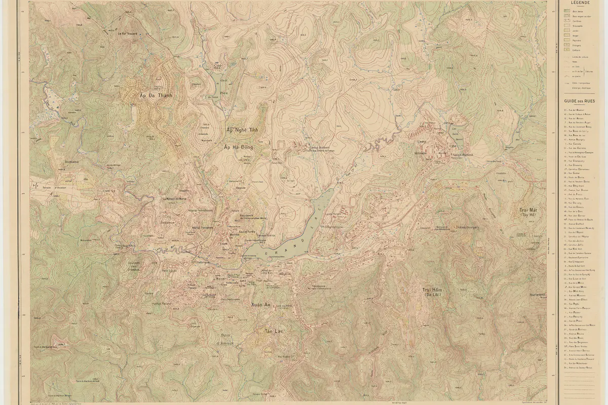
What this map does not do
This interactive Da Lat map is not a navigation app. It does not plan routes, does not know which pass is blocked and does not know which café is closed today. Its job is to show where places sit in relation to each other and send you to a guide with real opening hours, prices and caveats. When you are ready to go, tap “Directions” to open your map app with coordinates we have checked.
We re-check the Da Lat map coordinates every quarter and whenever we publish a new guide. If a pin looks off, a place has closed or you want to suggest one with clear coordinates, get in touch through our contact page. The base data is OpenStreetMap, an open map built by volunteers under the ODbL license (OpenStreetMap), and the map tiles are used under the OSM Foundation’s tile policy with attribution on the map.
First time in Da Lat? Start with our Da Lat travel guide on the home page for weather, food and where to stay, then come back here to plan your days. For a room close to the pins you want, see streets with cheap hotels in the center or where to stay in a homestay. Saigoneer’s long-running guide is a good companion read on the city’s food and cafés (Saigoneer).
FAQ
Is this Da Lat map free, and do I need to install anything?
It is free and runs in your browser, with no app or sign-up. The background comes from OpenStreetMap, and the list of 48 places with links to our guides is built into the page, so it still reads fine on a weak connection.
Does the Near me button store or send my location?
No. Your browser asks for permission only when you tap the button. The coordinates are used inside the page to calculate distances; they are not sent to any server, not saved in a cookie, and they disappear when you reload.
Are the distances on the Da Lat map driving distances?
No, they are straight-line distances from the middle of Xuan Huong Lake. Roads in Da Lat are longer because of hills, passes and lakes: about 1.3 times longer inside the city, and 1.5 to 2 times for outlying places such as the Dankia lakes or Cau Dat. The distance table in this article shows both figures.
What are the main areas of Da Lat for visitors?
We split the Da Lat map into six: the center around Xuan Huong Lake; the south along Prenn Pass and Tuyen Lam Lake; the north with Lang Biang and Dankia; the east with Trai Mat and Cau Dat; the west with Van Thanh flower village and Ta Nung; and far-out spots such as Samten Hills, Lien Khuong Airport and Pongour Waterfall.
How far is Da Lat city center from Lien Khuong Airport?
About 30 km by road; the straight-line distance on our Da Lat map is 23.6 km. Samten Hills is about 15 km from the airport, so it fits well into an arrival or departure day.
Do I need an offline map in Da Lat?
It is a good idea if you plan to go cloud hunting, climb Langbiang or ride through the pine forests, where signal comes and goes. Download an offline map of the area in your usual app, save your destinations and parking spots, carry a power bank and tell someone your route.
Sources
Facts in this article were checked against the sources below, accessed on Sep 28, 2026. Prices and opening hours change, so please double-check before you go.
- Viet Nam News: Art tourism map of Da Lat makes debut (Aug 30, 2024)
- VnExpress: Da Lat launches an art tourism map (Aug 29, 2024, in Vietnamese)
- Thanh Nien: Da Lat art tourism map launched (Aug 29, 2024, in Vietnamese)
- CafeF: Da Lat's first digital cherry blossom map (Jan 14, 2026, in Vietnamese)
- CafeF: Traffic changes in central Da Lat from August 1 (Jul 31, 2026, in Vietnamese)
- VnExpress International: 13 breathtaking places you must visit in Da Lat (Mar 22, 2025)
- Tuoi Tre News: Lam Dong declares emergency over landslides on Prenn Pass (Sep 23, 2026)
- Tuoi Tre News: 2 tourists rescued from Vietnam’s Central Highlands forest (Sep 30, 2024)
- VietNamNet: Peace and quiet in lesser-known destinations in Da Lat (Jan 19, 2019)
- Dan Tri: The romantic beauty of Da Lat’s pine forests (Sep 27, 2026, in Vietnamese)
- Saigoneer: Urbanist Travel’s Guide to Da Lat (Apr 28, 2021)
- OpenStreetMap: Copyright and license (ODbL); coordinates checked September 28, 2026
- OSM Foundation: Tile usage policy (operations.osmfoundation.org)
- Wikidata: coordinates of Da Lat landmarks (cross-checked September 28, 2026)
- Wikipedia (Vietnamese): Truc Lam Zen Monastery, Da Lat (checked Sep 28, 2026)
- Wikipedia: Haversine formula
- Wikipedia: Da Lat