Da Lat cloud forecast: will there be a sea of clouds tomorrow, where and when
Our Da Lat cloud forecast scores every sunrise for the next 7 days at six popular viewpoints, using live Open-Meteo data, and shows when to leave your hotel, how cold it will be and how to read the numbers yourself.
By Da Lat LoversPublished Updated How we reviewĐọc bản tiếng Việt

How we built this Da Lat cloud forecast
Every evening in Da Lat, someone in a hostel lobby asks the same question: “Will there be clouds tomorrow?” Locals call the dawn trip săn mây, cloud hunting, and it usually means a 3:30am alarm. Our Da Lat cloud forecast below tries to answer that question with numbers instead of luck.
It reads the hourly forecast for humidity, dew point, wind, low cloud and visibility around sunrise at six viewpoints and turns it into a 0–100 score for each of the next seven mornings. The general guide to seasons, tours, fees and photography lives in our Da Lat cloud hunting guide; this page is about reading the forecast well.
Free tool · refreshed hourly
Will there be clouds tomorrow morning?
A 0–100 score for the sunrise window at 6 cloud-hunting spots, built from forecast humidity, dew point, wind, low cloud and visibility. It’s an estimate, not a promise of clouds.
The 6 spots in this tool
Cau Dat tea hills
Elevation 1,599 m · From center ~25 km · Drive close
The busiest spot; an easy but long, unlit ride; wooden-deck cafés charge for service.
Da Phu hill
Elevation 1,584 m · From center ~10 km · Drive close
Close, free, a steep dirt walk at the end; slick after rain.
Du Sinh hill
Elevation 1,542 m · From center ~5 km · Drive close
Closest and lowest; better for thin mist than a thick sea of clouds.
Pinhatt peak (Tuyen Lam Lake)
Elevation 1,691 m · From center ~7 km · Long hike
About a 3-hour hike on a rough trail; go with a local guide.
Radar peak (Langbiang)
Elevation 1,929 m · From center ~12 km · Park with opening hours
The park opens at 7:30am, so no jeeps at dawn; the score shows whether this altitude sits above the clouds.
Nui Ba summit (Langbiang)
Elevation 2,167 m · From center ~12 km · Long hike
Highest and most likely above the clouds, but a 3-hour night climb; only with a guide and park permission.
How we calculate the score
- Time window: from 60 minutes before to 90 minutes after sunrise, using the hourly forecast points inside it.
- Moisture (35 pts): an average temperature–dew point gap of 1°C or less scores full marks, 4°C or more scores zero, linear in between.
- Calm air (25 pts): average 10 m wind of 5 km/h or less scores full marks, 20 km/h or more scores zero.
- Cloud/fog signal (40 pts): the higher of peak low-cloud cover and a fog level derived from visibility (1 km or less = 100%, 10 km or more = 0%).
- Minus 15 if 0.5 mm of rain or more falls in the window; minus 10 if average mid-level cloud is 70% or more (a grey sky above).
- Minus 15 if the fog signal is strong (60% or more) but the spot is less than 150 m above the model’s grid cell: you are likely standing in the fog, not above it.
- Bands: 70+ is “Very likely”, 45–69 “Possible”, below 45 “Unlikely”.
Leave-by time = sunrise − 20 min (arrive at first light) − riding time (distance ÷ 30 km/h) − parking and walking time.
Weather models use grid cells a few kilometers wide, so nearby spots can share data; the differences come from elevation. The thresholds are our own choice and will be tuned with feedback.
Weather data: Open-Meteo.com (CC BY 4.0). Coordinates: © OpenStreetMap contributors. For guidance only, not a substitute for official weather warnings.
How to use the Da Lat cloud forecast in 4 steps
There is nothing to install and no account. The tool runs in your browser, pulls free weather data and stores nothing personal. Here is the order we suggest:
- Start with the “best morning” box at the top. It names the day and spot with the highest score in the next seven days. Radar peak is left out of that box because the Langbiang park is still closed at sunrise.
- Pick the morning you are actually free with the row of day buttons. Each button shows that day’s top score in green, yellow or pink.
- Read each spot card: sunrise, leave-by time, dawn temperature, wind, humidity, dew point gap, low cloud and visibility. The note underneath tells you whether the spot is likely above or inside the fog.
- Check again at 8–9pm the night before. A Da Lat cloud forecast for the next 12 hours is usually much closer to reality than one for five or six days out. If the score drops sharply, sleep in.
The seven-morning grid at the bottom of the Da Lat cloud forecast is handy when you plan the whole trip. VnExpress (September 5, 2026) (in Vietnamese) recommends staying two or three days to improve your odds; the grid lets you put cloud hunting on the best morning and fill the others from our Da Lat travel overview.
How the Da Lat cloud forecast score works
We wanted a formula simple enough to check by hand. For each spot and day, the Da Lat cloud forecast takes the hourly forecast points between 60 minutes before and 90 minutes after sunrise. If the sun rises at 5:34am, that means the 5am, 6am and 7am values.
| Component | Points | Rule | Why |
|---|---|---|---|
| Moisture | 35 | Average temperature–dew point gap of 1°C or less: full marks; 4°C or more: zero | Wikipedia (Fog): fog forms when this gap drops below 2.5°C |
| Calm air | 25 | Average 10 m wind of 5 km/h or less: full marks; 20 km/h or more: zero | Stronger wind mixes the air and breaks up fog |
| Cloud/fog signal | 40 | The higher of peak low-cloud cover and a fog level derived from visibility (1 km or less = 100%, 10 km or more = 0%) | By definition, fog cuts visibility below 1 km |
| Rain | −15 | 0.5 mm or more of rain in the window | Rain at dawn means slick roads and a grey view |
| Sky above | −10 | Average mid-level cloud of 70% or more | A layered, overcast sky rather than a thin fog under early sun |
| Position vs. fog | −15 | Fog signal 60% or more, but the spot is less than 150 m above the model’s grid cell | You are probably standing in the fog and will see white all around |
The total is rounded and capped between 0 and 100. A score of 70 or more is “Very likely”, 45–69 is “Possible” and anything below 45 is “Unlikely”, shown in green, yellow and pink.
A real Da Lat cloud forecast example: September 29, 2026
When we ran the tool on the afternoon of September 28, 2026, the forecast for Cau Dat tea hills the next morning showed a dew point gap of about 0.1°C, average wind around 6 km/h, peak low cloud of 52% and minimum visibility of 380 m. That adds up to 35 points for moisture, about 23 for calm air and 40 for the fog signal, with no deductions: roughly 98.
Da Phu hill had the same moist, calm air but lost 15 points for position, ending near 81. The reason: Da Phu (1,584 m) sits only about 35 m above its model grid cell, while Cau Dat is about 212 m above its own. Your numbers will differ, since the data updates constantly.
How the Da Lat cloud forecast works out your leave-by time
Leave-by time equals sunrise minus 20 minutes (so you arrive at first light), minus riding time at 30 km/h on dark roads, minus time to park and walk. Cau Dat is about 25 km from the center, according to VnExpress (September 3, 2022) (in Vietnamese). With a 5:34am sunrise that gives about 4:09am, in line with the 4:00–4:15am departures in the timing table of our cloud hunting guide.
| Spot | Elevation | Grid cell | From center | Last stretch |
|---|---|---|---|---|
| Cau Dat tea hills | 1,599 m | ~1,387 m | ~25 km (VnExpress, 2022) | Park and walk ~15 min |
| Da Phu hill | 1,584 m | ~1,549 m | ~10 km (VnExpress, 2022) | Dirt slope ~20 min |
| Du Sinh hill | 1,542 m | ~1,549 m | ~5 km (VnExpress, 2022) | ~15 min |
| Pinhatt peak | 1,691 m | ~1,310 m | ~7 km to Tuyen Lam Lake (Wikipedia) | ~3-hour hike (VnExpress, 2022) |
| Radar peak (Langbiang) | 1,929 m | ~1,635 m | ~12 km (Wikipedia) | Gate opens 7:30am (Dalattourist) |
| Nui Ba summit (Langbiang) | 2,167 m | ~1,635 m | ~12 km (Wikipedia) | ~3-hour climb (VnExpress, 2024) |
Limits of any Da Lat cloud forecast: when the score is likely wrong
No tool can promise clouds, ours included. A guide interviewed by VnExpress (September 5, 2026) (in Vietnamese) put it plainly: being at the right place in the right season is no guarantee, and the best clouds sometimes last only about 30 minutes. These are the weak spots of this Da Lat cloud forecast:
- Grid cells a few kilometers wide. Weather models split the land into squares several kilometers across. Da Phu and Du Sinh share one cell, and so do Radar and Nui Ba, so they get the same humidity, wind and visibility. Differences between spots come mostly from elevation.
- Fog is extremely local. A small valley with a lake or freshly watered vegetable fields can fill with fog while the model cell stays drier, and the model can also paint fog over a whole area when only a few basins have it.
- Elevation only adjusts temperature. According to the Open-Meteo documentation, the elevation setting is used for statistical downscaling; low cloud and visibility stay at the grid-cell value. That is why we added the “position vs. fog” rule.
- Days five to seven are a trend, not a forecast. Open the page again the evening before.
- A high score does not mean you can get there. Radar peak can score well but the park opens at 7:30am; Pinhatt and Nui Ba need a roughly three-hour night hike.
In short, the Da Lat cloud forecast score answers “are the conditions right?”, while “where exactly should I stand?” still takes local experience. If you have just come back from a hill, tell us through the contact page so we can tune the thresholds.
Reading the forecast like a cloud hunter: humidity, dew point, inversions, wind
How the sea of clouds forms (night cooling, valley fog) is covered in the science section of our cloud hunting guide. Here we go one step further: what each number in a forecast tells you, so the Da Lat cloud forecast score makes sense and you can judge any weather app yourself.
95% humidity is not the whole story: watch the dew point gap
The dew point is the temperature air must cool to before water vapor starts to condense. As the Wikipedia entry on dew point explains, 100% relative humidity means the dew point equals the air temperature. The entry on fog adds that fog forms when the gap between temperature and dew point falls below 2.5°C.
Why use the gap instead of humidity? Relative humidity swings with temperature through the day, while the gap tells you directly how far the air is from condensing. A gap of 0–1°C at 5am is a great sign. A gap of 3–4°C rarely brings thick fog, even if humidity still reads a healthy-looking 80%.
Temperature inversions: the lid that holds the sea of clouds
Normally air gets colder as you climb. In an inversion the air near the ground is colder than the layer above it. The Wikipedia article on inversions notes that this blocks vertical mixing and is stronger in valleys and basins. Le Dinh Quyet, head of forecasting at the Southern Regional Hydro-Meteorological Center, told VietNamNet in December 2024 that a thick fog over Ho Chi Minh City came from a cold air mass plus high humidity, with morning humidity above 80% across the region.
Da Lat adds terrain to that recipe: cold night air drains into the valleys, the inversion caps it, and the top of the fog turns flat as a table. Consumer forecasts rarely say “inversion”, but you can infer it from the combination: a clear night, light wind, a small dew point gap and mid-level cloud near 0%. Vietnam’s national forecasting center gave Dan Tri (in Vietnamese) a similar explanation for fog in Hanoi in February 2024: an inversion layer and calm weather pressing moist air against the ground.
Wind: under 5 km/h is ideal
Wind ruins more cloud-hunting mornings than anything else. Moderate to strong wind stirs the air near the ground and stops fog from forming, and VnExpress (September 5, 2026) lists “wind that is not too strong” as a must. This Da Lat cloud forecast gives full marks below 5 km/h and none from 20 km/h, an editorial threshold you can apply to any app.
Low cloud vs. fog: two names for the same thing?
Nearly. Open-Meteo defines low cloud as clouds and fog up to 3 km, and says visibility depends on low cloud, humidity and aerosols. When forecast visibility drops below 1 km, the grid cell is officially foggy. When low cloud is high but visibility stays at several kilometers, the cloud may be floating over your head instead.
So the Da Lat cloud forecast takes whichever signal is stronger. Quick rule: high low cloud, low visibility and mid-level cloud near 0% is the winning combination; high low cloud with rain and thick mid-level cloud usually means a grey, drizzly dawn.
Standing above the clouds or inside them
This is where most disappointments happen. If your viewpoint sits level with the fog, you see white for a few dozen meters and nothing else. The sea of clouds works when you stand above the top of the fog and look down. The tool estimates this by comparing the spot’s elevation with the model’s average grid-cell height; 150 m or more above it triggers the “above the forecast fog layer” note.

The 150 m threshold is our own assumption, since fog depth changes from night to night. Treat the note as a hint, not a guarantee, and compare it with what people are posting from the hills that week.
Afternoon rain: good or bad?
Spot-by-spot notes: where the Da Lat cloud forecast works best
Descriptions of each place are in cluster E of our 30 places to visit in Da Lat. Below is only our take on how well the forecast works at each one.
Cau Dat tea hills (1,599 m)
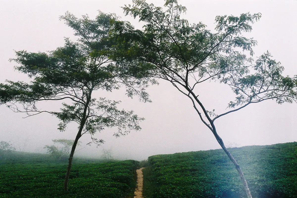
The viewpoint sits about 200 m above its model grid cell, so when the tool shows a strong fog signal, you have a good chance of standing above the cloud layer. Saigoneer (March 16, 2023) put the tea hill 23 km from town; the catch is that long, unlit ride and weekend crowds (Saigoneer). Service fees at the wooden-deck cafés are covered in the fee section of our guide.
Da Phu hill (1,584 m) and Du Sinh hill (1,542 m)
Both are close to town and share a grid cell whose average height is almost the same as the hills. When the model forecasts thick fog, the tool usually takes off position points, because you are likely to be inside it. Mornings with thin fog pooling only in the valley floors are when these two shine.
VnExpress International (November 8, 2024) recommends Da Phu, about 10 km from the center, between 5am and 6am in autumn, and quotes a visitor saying mist hunting in Da Lat is easier than in Ta Xua: you just need to wake up early. A “Possible” at Da Phu is still a sensible choice if you do not want a long ride.
Pinhatt peak (1,691 m)
Pinhatt stands almost 400 m above its model grid cell and looks down on Tuyen Lam Lake, so in theory it is where an “above the clouds” call is most reliable. But VnExpress (September 3, 2022) (in Vietnamese) describes a roughly three-hour walk from the Da Tien tourist area on a difficult trail and recommends a local guide. The leave-by time in the Da Lat cloud forecast includes that climb, so it usually lands around 1:30–2am.
Radar peak and Nui Ba summit (Langbiang)
At 1,929 m and 2,167 m, the two highest spots almost always sit above valley fog; Wikipedia lists Langbiang at 2,167 m. However, Dalattourist, which runs the Langbiang park, lists opening hours of 7:30am–5pm and a 6 km road to Radar peak (Dalattourist (in Vietnamese), checked September 28, 2026). The Da Lat cloud forecast still scores Radar so you know whether that altitude is above the clouds, but it shows no leave-by time and leaves Radar out of the best-morning box.
Nui Ba is managed by Bidoup – Nui Ba National Park. According to VnExpress (July 26, 2024) (in Vietnamese), the climb takes about three hours with steep, high steps near the top, it is easy to get lost, and hiring a local guide is advised; about 30 people searched for three lost hikers in heavy rain on July 24, 2024. Only consider it with a guide and after checking park rules.

Why Hon Bo and Thien Phuc Duc are missing
Both are popular, and VnExpress International (October 29, 2020) mentions Hon Bo hill as a sunrise favorite. As of September 28, 2026, though, we could not find coordinates and elevations for either on OpenStreetMap or Wikidata. We would rather leave them out than drop a guessed pin and give you a wrong departure time. They will be added once verified.
Which season makes the Da Lat cloud forecast most reliable
The Da Lat cloud forecast behaves differently through the year. This is our editorial reading of the formula against the climate; month-by-month numbers are in our weather guides.
- End of the rainy season (September–October): the air is so moist that the moisture component is almost always maxed out and many days score high everywhere. Pay attention to the rain and “inside the fog” notes. See Da Lat weather in October.
- Transition (November): more clear nights, still humid, drier roads. We expect high scores to be the most trustworthy now. Details in Da Lat weather in November.
- Cool dry season (December–March): drier and windier, so moisture and calm-air points drop. A “Very likely” in these months is well worth the alarm. See Da Lat weather in December.
- April–August: humidity climbs and fog is common, but rain and mid-level cloud often come with it. Watch the “sky above” deduction to avoid grey mornings.
A 12-month humidity and rain-day table, plus the conflicting season claims in the Vietnamese press, is in the best months section of our guide, so we will not repeat it here.
Staying safe on a pre-dawn ride
For spots you can ride to, leave-by times usually fall between 4am and 4:50am, which means riding in the dark, in fog and in the cold. Dawn temperature is shown on every spot card; forecasts on September 28, 2026 put the hills at roughly 11–15°C, a shock if you have come up from Ho Chi Minh City.
- Thick fog means low visibility. The tool scores highest when visibility drops below 1 km, which is also when riding is most dangerous. Use low beams, slow down and keep your distance.
- Wet, steep roads. On September 25, 2026, Tuoi Tre News reported that a motorbike carrying two Indian tourists skidded on Prenn Pass in heavy rain and one died (Tuoi Tre News). After a wet night, leave 10–15 minutes earlier than the tool suggests and ride slowly.
- License and insurance. Vietnam’s rules on riding a motorbike as a foreigner, plus emergency numbers, are in the safety part of our Da Lat travel tips. If in doubt, book a driver.
- Night hikes. For Pinhatt and Nui Ba, go in a group with a guide and a headlamp, and tell someone your plan.
Pairing the Da Lat cloud forecast with our other pages
This tool is one piece of a set we built for cloud hunters. A few simple combinations:
- The night before: check the tool, then the live Da Lat weather widget on our homepage for rain chances and the day’s low.
- What to wear: tap “what to wear?” next to the dawn temperature to open what to wear in Da Lat, especially the three-layer system.
- No long ride: a sunrise table for a valley-view café near the center is in our Binh Minh Oi Da Lat review.
- Whole-trip planning: costs, motorbike rental and pass conditions are in our Da Lat travel tips.
Bottom line
A Da Lat cloud forecast cannot replace standing on a hill at 5am, but it can save you from pointless alarms and help you pick a viewpoint that suits that night’s fog. Remember three things: a small dew point gap, light wind, and standing above the fog.
We will tune the thresholds after each season. If you find a sea of clouds on a morning the tool called “Unlikely”, or the other way round, let us know. Weather data: Open-Meteo.com; coordinates: © OpenStreetMap contributors.
FAQ
What Da Lat cloud forecast score is worth getting up for?
A score of 70 or more (green, “Very likely”) is worth the alarm. 45–69 is “Possible” and fine if the spot is close. Below 45 is rarely worth a long ride. Always check again at 8–9pm the night before, when the forecast is more accurate.
Where does the Da Lat cloud forecast get its data, and is it free?
Weather data comes from Open-Meteo (CC BY 4.0) and coordinates from OpenStreetMap. The tool is free, runs in your browser, needs no account and collects no personal data.
Why do Da Phu and Du Sinh often score lower than Cau Dat on foggy mornings?
Those hills are about as high as the model’s average grid-cell height, so when thick fog is forecast you are likely standing inside it. The tool deducts 15 position points. Cau Dat sits about 200 m above its grid cell, so it is more likely to look down on a sea of clouds.
How is the leave-by time calculated?
Sunrise minus 20 minutes to arrive at first light, minus riding time (distance divided by 30 km/h) and time to park, walk or hike. For Cau Dat, about 25 km away, a 5:34am sunrise means leaving at about 4:09am.
What is the dew point gap and what number is good?
It is the difference between air temperature and dew point. The smaller it is, the closer the air is to saturation. Wikipedia says fog forms when the gap is under 2.5°C; the tool gives full moisture points at 1°C or less.
Does the Da Lat cloud forecast cover Hon Bo peak?
Not yet. As of September 28, 2026, we could not verify coordinates and elevations for Hon Bo peak or Thien Phuc Duc hill on OpenStreetMap or Wikidata, so we left them out rather than risk wrong departure times.
Sources
Facts in this article were checked against the sources below, accessed on Sep 28, 2026. Prices and opening hours change, so please double-check before you go.
- VietNamNet: Meteorologists explain persistent fog in Ho Chi Minh City (December 4, 2024)
- VnExpress International: Top spots in Da Lat for a misty sunrise experience (November 8, 2024)
- VnExpress International: Five popular spots for cloud hunting in Da Lat (October 29, 2020)
- Saigoneer: I Went Cloud-Hunting and Found Peace Atop Đà Lạt’s Tea Hill (March 16, 2023)
- Tuoi Tre News: Indian tourist killed in motorbike crash on Da Lat mountain pass (September 25, 2026)
- VnExpress: Reading the weather for cloud hunting in northern Vietnam (September 5, 2026) (in Vietnamese)
- VnExpress: Easy cloud-hunting spots in Da Lat (September 3, 2022) (in Vietnamese)
- VnExpress: Safety notes for climbing Lang Biang (July 26, 2024) (in Vietnamese)
- Dan Tri: Why dense fog appeared in Hanoi (February 2, 2024) (in Vietnamese)
- Dalattourist: Langbiang tourist area, opening hours and Radar peak road (checked September 28, 2026) (in Vietnamese)
- Open-Meteo: Forecast API documentation (low cloud, visibility, elevation downscaling; checked September 28, 2026)
- Open-Meteo: Elevation API, Copernicus 90 m DEM (checked September 28, 2026)
- OpenStreetMap: spot coordinates (nodes 11916396494, 11810221807, 12880524493, 7202547685, 2090212777, 2688028631)
- Wikipedia: Fog (checked September 28, 2026)
- Wikipedia: Dew point (checked September 28, 2026)
- Wikipedia: Inversion (meteorology) (checked September 28, 2026)
- Wikipedia: Langbiang (checked September 28, 2026)
- Wikipedia (Vietnamese): Tuyen Lam Lake, 7 km from the center (checked September 28, 2026)