Where is Da Lat? Location, province and the new ward names
Da Lat is in Lam Dong Province, on a cool plateau in Vietnam’s southern highlands. Its addresses changed with the 2025 administrative reforms, so maps, bus tickets and booking sites may show old and new names side by side.
By Da Lat LoversPublished Updated How we review
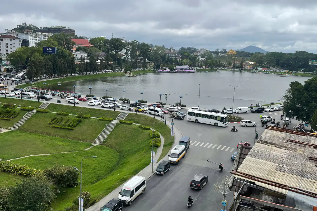
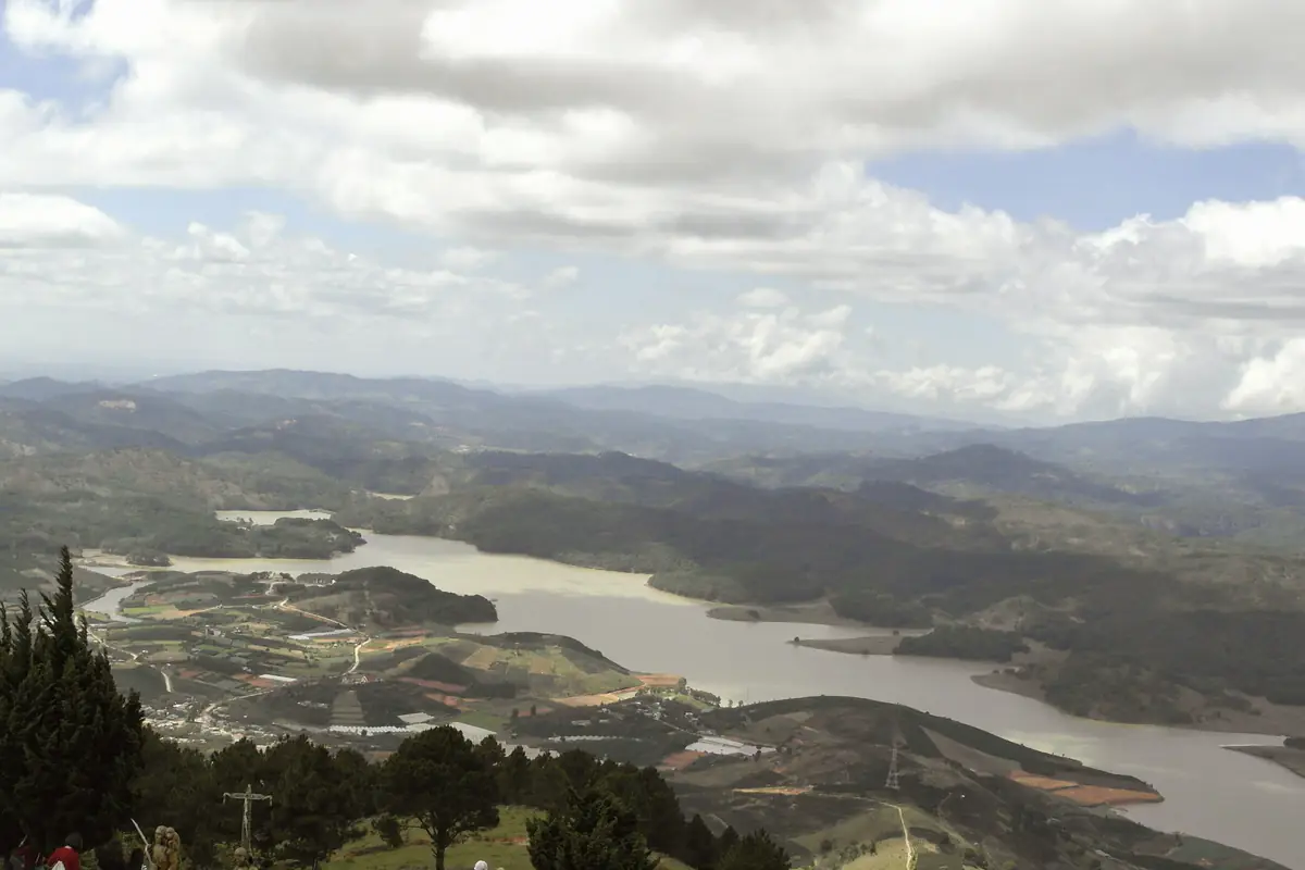
Xuan Huong Lake and part of central Da Lat from above, June 2025. Photo: Bún bòa / CC0.
Your bus ticket says “Lam Dong”, your hotel booking says “Xuan Huong - Da Lat Ward”, and a friend still talks about “Da Lat City”. These names refer to different areas: Lam Dong is the province, Xuan Huong - Da Lat is one ward, and Da Lat is the familiar city name. When you book a ride or a room, check the full address as well.
Where is Da Lat on the map?
Da Lat sits on the Lang Biang Plateau, also called the Lam Vien Plateau, at an average of about 1,500 m above sea level, according to the city’s official gazetteer. The plateau belongs to Vietnam’s Central Highlands, and the town spreads across its southern side. The altitude is the main reason Da Lat is so much cooler than the lowlands.
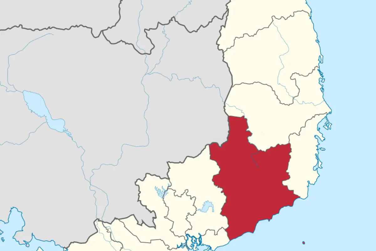
The province around it is far bigger than it used to be. Lam Dong’s official introduction describes it as a mountainous coastal province in south-central Vietnam that runs from the southwestern edge of the Central Highlands, along the Cambodian border, down to 192 km of coastline. Da Lat is still a highland town, but its province now has beaches and an island.
How far is Da Lat from Ho Chi Minh City, Nha Trang and Phan Thiet?
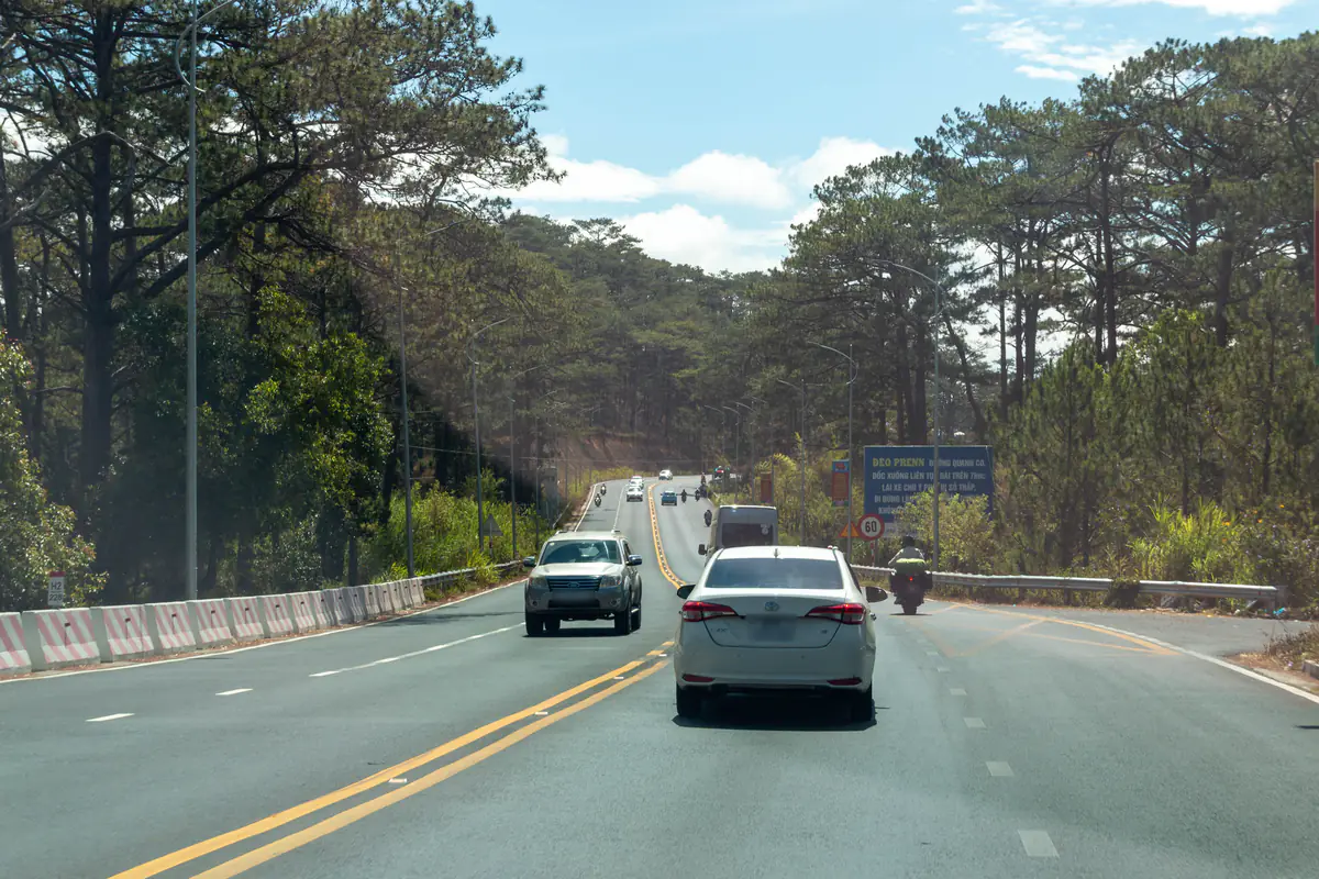
Every road into Da Lat climbs a mountain pass, so travel times are longer than the distances suggest. These are reported figures, not bus timetables.
| From | Distance, time | Main route | Source |
|---|---|---|---|
| Ho Chi Minh City | About 300 km, 5-6 hours | Long Thanh - Dau Giay Expressway, Highway 20, Bao Loc and Prenn passes | VnExpress, March 6, 2026 |
| Nha Trang | 145 km via Khanh Le Pass, or 200 km via Phan Rang; 5-6 hours | Highway 27C, or Highway 1 then Highway 27 | VnExpress, March 6, 2026 |
| Phan Thiet; the distance from Mui Ne depends on your pickup point. | About 160 km, at least about 3.5 hours | Highway 28B over Dai Ninh Pass, then Highway 20 | Thanh Nien, April 14, 2025 |
| Buon Ma Thuot | Varies with pickup point and route; check the exact itinerary when you book | Highway 27 | VnExpress, March 6, 2026 |
Flying is the quick option: Lien Khuong Airport reopened on August 19, 2026 after runway repairs. Routes, fares and transfers are in our guide to flights to Da Lat, and buses, limousine vans and private cars from the south are covered in Ho Chi Minh City to Da Lat.
Is Da Lat a province?
No. Da Lat is a town in Lam Dong Province, and since 2025 that province has been about two and a half times its former size. Under Resolution 202/2025/QH15, passed by the National Assembly on June 12, 2025, Dak Nong, Binh Thuan and Lam Dong were merged into a single province that kept the name Lam Dong. Its new government started work on July 1, 2025. The merged province covers 24,233.07 km², according to the resolution, and its administrative center is the former Da Lat City, as the provincial introduction puts it.
For travelers, this means Mui Ne, Phan Thiet and Gia Nghia are now in the same province as Da Lat. The Mui Ne beach strip is Mui Ne Ward, formed from the old Ham Tien and Mui Ne wards and Thien Nghiep commune. A bus from Mui Ne to Da Lat is now a trip within one province, so booking apps may list the pickup under “Lam Dong”.
Is Da Lat still a city?
Not as an administrative unit. The Law on Local Government Organization, No. 72/2025/QH15 (June 16, 2025), cut Vietnam’s local government to two tiers: provinces, and below them communes, wards and special zones. Article 51 ended the district tier, which included provincial cities like Da Lat, on July 1, 2025. Since then there has been no Da Lat City government; the old wards and communes were regrouped into five wards administered directly under Lam Dong Province.
Official documents now say “the former Da Lat City”. For planning, the province treats the five wards as one “Da Lat urban area”: on September 6, 2026 it approved the brief for a master plan covering more than 68,000 ha. In everyday life, people still say Da Lat City, and landmarks such as Da Lat Market, Da Lat Railway Station and the Da Lat Inter-provincial Bus Station keep their names. Only the administrative part of an address has changed.
What are Da Lat’s new wards?
Resolution 1671/NQ-UBTVQH15 created five wards from the old city’s 12 numbered wards and 4 communes, plus Lac Duong town and Lat commune from the neighboring district.
| Ward | Formed from | Areas and places visitors look for |
|---|---|---|
| Xuan Huong - Da Lat | Old Wards 1, 2, 3, 4 and 10 | Xuan Huong Lake, Da Lat Market, the railway station, Tuyen Lam Lake, Datanla Falls |
| Cam Ly - Da Lat | Old Wards 5 and 6, Ta Nung commune | Van Thanh flower village, the road to Ta Nung |
| Lam Vien - Da Lat | Old Wards 8, 9 and 12 | Mai Anh Dao Street, the Valley of Love |
| Xuan Truong - Da Lat | Old Ward 11, Xuan Tho, Xuan Truong and Tram Hanh communes | Trai Mat, the Cau Dat tea hills |
| Lang Biang - Da Lat | Old Ward 7, Lac Duong town, Lat commune | Langbiang Mountain, Dankia Lake, Cu Lan Village |
An address in either outer ward can still be a long way from central Da Lat. Xuan Truong - Da Lat’s own website puts the ward about 22 km from the center, even though Trai Mat is much closer, and Lang Biang - Da Lat stretches from old Ward 7 out to Lac Duong town and Lat commune at the foot of Langbiang. If a listing gives either ward, check the exact pin before you book.
Two places called Lac Duong
The ward is spelled Lang Biang, as in the resolution; the mountain and the tourist area usually appear as Langbiang. Our Langbiang hike guide covers the trail and the jeep ride up.
Old and new addresses: how to avoid mix-ups
Reviews, older articles and map listings were not all updated at the same time, so one hotel can appear as “Ward 1, Da Lat City” on one site and “Xuan Huong - Da Lat Ward” on another. A few habits help:
- Keep “Da Lat” in the search. The province now includes several former towns and cities, such as Da Lat, Bao Loc, Phan Thiet, La Gi and Gia Nghia. Phan Thiet also has a Ho Xuan Huong Street, so “Ho Xuan Huong, Lam Dong” could send you to the coast.
- Match by street name and number. The reorganization renamed administrative units, not streets. Match the street address and map pin when listings use different ward names.
- Give drivers a landmark. Name the street, the inter-provincial bus station or Da Lat Market rather than just “Lam Dong”.
- Know that the airport is outside Da Lat. Lien Khuong sits in Duc Trong commune, not in any of the five Da Lat wards. On August 27, 2026, the province asked the central government to upgrade Duc Trong to a ward; the outcome is still to be confirmed.
Writing a Da Lat address
To see how the main sights cluster on the ground, start with the Da Lat map and 30 places to visit in Da Lat. Weather, budgets and where to stay are in our Da Lat travel tips.
If you spot a ward name or boundary in this guide that has changed, let us know and we’ll update it.
FAQ
Which province is Da Lat in?
Lam Dong Province. On July 1, 2025, Lam Dong merged with Dak Nong and Binh Thuan under Resolution 202/2025/QH15 (June 12, 2025) and kept its name. The provincial administrative center is in Da Lat.
Is Da Lat in the Central Highlands?
Geographically, yes: Da Lat sits on the Lang Biang (Lam Vien) Plateau, part of the Central Highlands, at an average elevation of about 1,500 m. The provincial website describes today’s Lam Dong as a mountainous coastal province in south-central Vietnam, reaching from the edge of the Central Highlands to the sea.
Is Da Lat still a city?
Not administratively. Vietnam’s district tier, which included Da Lat City, was abolished on July 1, 2025 under Law No. 72/2025/QH15. The area is now five wards under Lam Dong Province, though people still call it Da Lat City in everyday speech.
Is Mui Ne in the same province as Da Lat now?
Yes. The former Binh Thuan Province became part of Lam Dong on July 1, 2025. The Mui Ne beach area is now Mui Ne Ward. The road from Phan Thiet to Da Lat is about 160 km via Highway 28B; the distance from Mui Ne depends on your pickup point.
How far is the airport from Da Lat?
Lien Khuong Airport (DLI) is about 28 km from central Da Lat, in Duc Trong commune. It reopened on August 19, 2026 after runway repairs.
Sources
These are the sources used for this article. It was last updated on Oct 18, 2026; prices and opening hours may have changed since, so please double-check before you go.
- Vietnam Government Portal: full text of Resolution 1671/NQ-UBTVQH15 on commune-level units in Lam Dong (passed June 16, 2025, published June 20, 2025) (in Vietnamese)
- LuatVietnam: Resolution 202/2025/QH15 of the National Assembly on provincial-level reorganization (June 12, 2025) (in Vietnamese)
- LuatVietnam: Law on Local Government Organization No. 72/2025/QH15 (June 16, 2025) (in Vietnamese)
- Lam Dong Provincial Party Congress portal: introduction to Lam Dong Province (viewed October 18, 2026) (in Vietnamese)
- Da Lat Gazetteer (Địa chí Đà Lạt), Part 2, Chapter I: Nature, geographic location, Lam Dong provincial portal (viewed October 18, 2026) (in Vietnamese)
- Wikipedia: Lam Vien Plateau (viewed October 18, 2026) (in Vietnamese)
- Xuan Truong - Da Lat Ward portal: about the ward (August 4, 2025) (in Vietnamese)
- Thanh Nien: The name Da Lat appears in all five wards after the reorganization (April 19, 2025) (in Vietnamese)
- Thanh Nien: Da Lat gets creative in naming its new wards, including pre-merger figures for the three provinces (April 25, 2025) (in Vietnamese)
- Dan Tri: Lam Dong plans five wards to preserve Da Lat’s character (September 6, 2026) (in Vietnamese)
- Dan Tri: Lam Dong submits plan to create three wards (August 27, 2026) (in Vietnamese)
- Kenh14: From July 1, check your Da Lat destination name or end up at the coast (July 1, 2025) (in Vietnamese)
- VnExpress: Five routes to Da Lat while Lien Khuong Airport is closed (March 6, 2026) (in Vietnamese)
- Thanh Nien: The shortest roads from Binh Thuan and Dak Nong to Lam Dong (April 14, 2025) (in Vietnamese)
- VnExpress: Lien Khuong Airport to reopen from mid-August (June 15, 2026) (in Vietnamese)
- Bao Chinh Phu: Lien Khuong Airport resumes operations from August 19 (June 15, 2026) (in Vietnamese)